DEVOURED
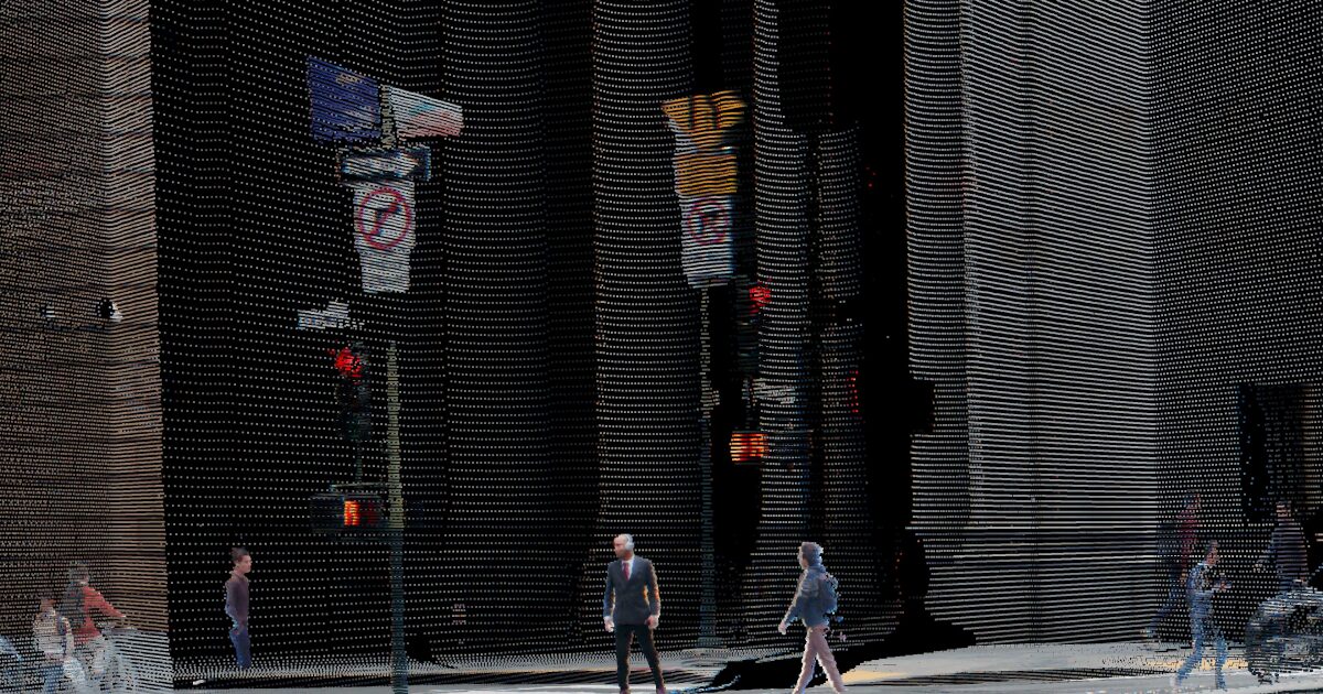
World's first native color LiDAR gives machines human-like vision
Ouster's new Rev8 sensor family introduces the world's first LIDAR with native color, fusing color directly into every data point for human-like machine vision.
What: Ouster's Rev8 sensor family, featuring the OS1 Max, provides native color LIDAR, combining 3D geometry and color in a single data point. The OS1 Max detects objects up to 200 meters at 10% reflectivity (500 meters optimal) and handles extreme lighting. Early adopters include Google and Volvo.
Why it matters: Integrating color directly into LiDAR data at the hardware level simplifies perception systems for autonomous vehicles and robotics by eliminating the need for complex, error-prone camera-LiDAR sensor fusion, enabling more robust "physical AI."
Deep dive
- Ouster's new Rev8 sensor family is the first LiDAR to fuse color directly into every point of data, providing native color.
- This differs from traditional systems that combine monochrome LiDAR for geometry with separate cameras for color, which introduces calibration errors and latency.
- The flagship OS1 Max model is a 256-channel sensor with a detection range up to 200 meters at 10% reflectivity and up to 500 meters under optimal conditions.
- It operates across extreme lighting conditions, from near-total darkness (1 lux) to intense direct sunlight (2,000,000 lux), with 48-bit color depth and 116 dB dynamic range.
- The technology is built on Ouster's L4 chip, co-developed with Fujifilm, which processes up to 20 trillion photons per second.
- CEO Angus Pacala states Rev8 doubles the range and resolution of its previous Rev7 generation.
- Early adopters include Google, Volvo Autonomous Solutions, Skydio, PlusAI, and Seegrid.
- Ouster acquired computer vision specialist StereoLabs in February 2026 for $38 million plus shares, signaling a move towards offering full perception platforms.
- Rev8 sensors are available to order, with shipments expected to begin this quarter.
Decoder
- LIDAR (Light Detection and Ranging): A remote sensing method that uses pulsed laser to measure distances, generating precise 3D maps of environments.
- Native color LiDAR: A LiDAR sensor that captures both 3D geometric data and color information simultaneously within each data point, rather than fusing data from separate LiDAR and color camera sensors.
- Reflectivity: The percentage of light that a surface reflects. Lower reflectivity (e.g., 10%) means the surface absorbs most light, making it harder for sensors to detect.
- Lux: A unit of illuminance, measuring luminous flux per unit area. It quantifies how much light illuminates a surface.
- Dynamic range: The ratio between the brightest and darkest measurable light intensities in an image or sensor output.
Original article
Full article content is not available for inline reading.
Explore all 57 articles in today's digest
Fresh dev news, AI-digested daily. Never miss a trend at devoured.fyi